0/00
 Saturday 9th 36-52F, 2-11C, hard, white, overnight frost, thin high cloud, sunny and calm. Sou'westerly winds gusting to only 8m/s or 15mph later. A good day for a longer ride but are my legs up to it yet? I could head north east as there are plenty of potential goals in that direction. Perhaps I just need a longer ride to rid my legs of the aches from last week's longer ride?
The isolated, former farmhouse perched on its 20 meter high plateau.
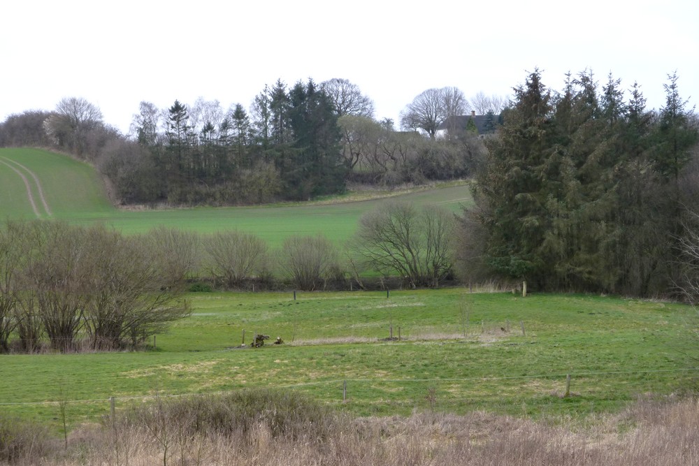
Denmark's gentle contours magnify the slightest elevation and make it excellent walking and cycling country. One can gain a viewpoint without unnecessary exertion or having to expend long hours just reaching there. I checked one of the free, online mapping services [Grundkort] and was surprised at how little the plateau was raised above the surrounding countryside. My regular loop through the forest brings me to viewpoint just as I exit the trees to look down the slope to another hamlet. This too is raised only 20 meters above the houses lining the road but is a fine, rough descent for a pleasant walk.
No doubt the low contours meant that prehistoric burial mounds and sacred places could gain greater importance without requiring massive earthworks. Early Denmark must have been heavily forested which would require extra elevation for a site to become noticeable in the landscape.
It is said that some of the tallest local hills were once frozen lakes from the ice ages. The ground sprang back up once the lake had melted and the bed was freed from the crushing weight, later leaving the new hills exposed. The rest of the landscape would already have been scraped flat by the advance and retreat of the ice age glaciers. Once the ice was gone the new hills would not have been eroded. It seemed an interesting and quite unexpected way of forming hills when I first read about it. It is not difficult to imagine that the steep sides of many of these small hills suggest an inversion of the depth contours of the ancient frozen lakes.

The red arrow on the contour image shows the 129 meter, highest peak at Frøbjerg Bavnehøj amongst several others nearby at up to 120m. Though Wiki suggests 131m = 430 ft. Frøbjerg Bavnehøj is the highest point on the island of Fyn. [Frø means seed. Bjerg means hill. Bavne means beacons. Høj means high. The hill is supposedly named after a fertility god.]
Pleasant, hilly lanes thread there way past these high points and the height itself is used for a annual meetings and popular outdoor plays. An image search for "frøbjerg bavnehøj" will provide some illustrations of the activities. The entire area around Tommerup Stationsby [the nearest shopping village] is well worth a visit for its undulating, rural beauty.
 I once spent a very early and chilly morning on the top recording a dawn, partial eclipse through a small telescope with my camera. I clearly remember the cattle in the fields, spread out across the misty landscape below me, greeting the dawn. Mysterious standing stones guard the steeply climbing path from the public car park. During festivities there the sloping fields on the flanks of the hill are full of cars.
Just a brisk walk down the road and back to enjoy the sunny morning. I met a neighbour walking his dog in the lane and he stopped to chat to a car driver later on. I glanced back when their voices could be clearly heard from hundreds of yards away. It is amazing how far sound travels when it is quiet in the countryside. The clear water bubbling up in the local field is still pouring down a drain. I rang the plumbers responsible for our water supply and it looked as if they dug around the spot at the time. Yet still the water pours at several buckets full per minute. No sign or sound of our robin today.
Set off after coffee to take in three villages in a row. It became progressively more cloudy and windy. I could have saved myself the ride to the furthest village because both of my goals were closed on Saturdays. Coming back, I ran across about fifty older children [14-15 year-olds?] without a clue about traffic safety. They were scattered in small groups over a couple of miles and mostly just ambling along the rural lane. Sometimes they were up to eight abreast and completely closing off the roadway. I twice had to shout to get them to let me through. They were all very cheerful and self confident with many of them calling out a greeting as I passed, pedalling hard against the wind. No sign of any supervising adults or even a coach to pick them up at the main road. Rather chilly headwind all the way back but I wore my fingerless mitts for the first time this year with fair comfort. Chatted with a cattle farmer who was curious about the trike. Only 36 miles but passed the 1000 mile mark for this year.
Click on any image for an enlargement.
00\0
No comments:
Post a Comment